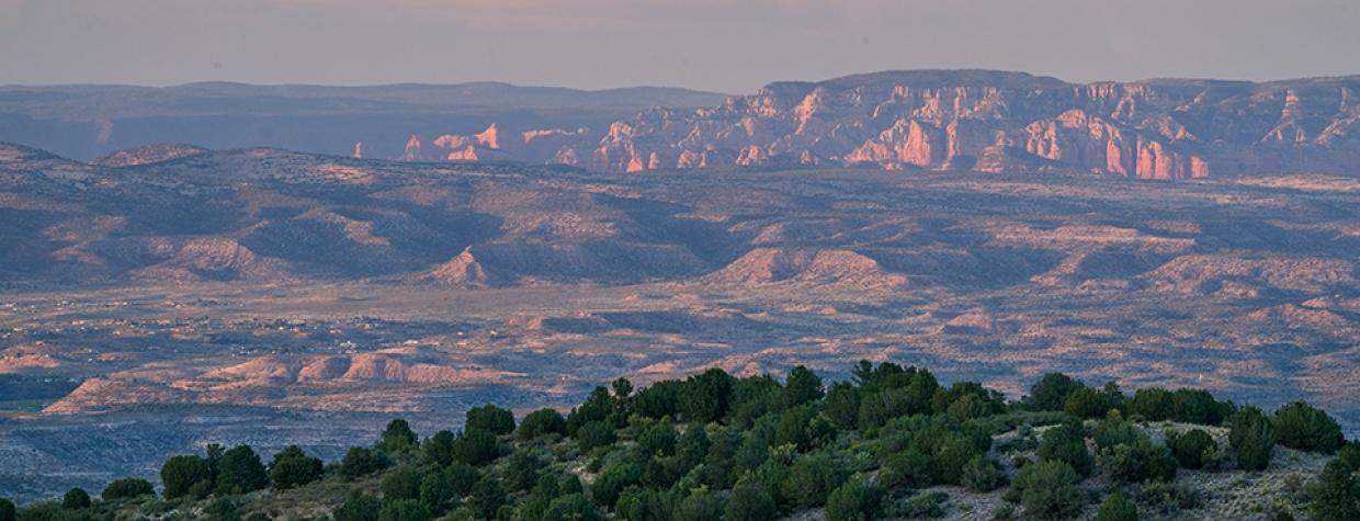
Prescott National Forest, Verde Valley
It takes a lot for a scenic drive to become a Scenic Drive. That’s a goofy way of saying we at Arizona Highways try to publish the best of the best. Because of that, there are more than a few misses that get driven but never make it into the magazine. But sometimes, to mix a couple of metaphors, you throw a dart and hit a home run. Cherry Creek Road, which includes a historic mining town and pristine views of the Prescott National Forest, is that dart. Or that home run. Or both.
One of the great things about this drive is that just about any vehicle can handle it — especially the first part, which begins on State Route 169 east of Prescott. The paved part of Cherry Creek Road heads north through scrub vegetation pockmarked by white granite formations reminiscent of what you’d find at the Granite Dells, which cradle the Prescott area’s Watson and Willow lakes. At Mile 3.5, near a bend in the road that offers a nice view of the surrounding Black Hills, you’ll spot your first ponderosa pine. A half-mile later, the ponderosas are everywhere, along with smaller deciduous trees such as ashes and oaks. If you visit in mid- to late October, you’ll catch the height of the latter trees’ autumn hues.
Six miles into the drive, you’ll come to the small town of Cherry, whose history as a mining hotbed dates to the 1870s. That history is marked by plenty of speculation but not much actual ore production, possibly because a railroad branch line, touted in the early 1900s as the key to unlocking the town’s potential, never materialized. Once a community of some 400 people, Cherry today has a handful of residents and numerous structures from its mining heyday; while they’re on private land, many are easily viewed from the road. Also check out the cemetery, which is behind Cherry’s fire station. Those buried there include members of the Allen family, prominent pioneers who were among the Verde Valley’s earliest settlers.
Continuing on, Cherry Creek Road, now a well-maintained dirt path, skirts a steep canyon on the right and crosses a few one-lane bridges. It also continues to climb. By Mile 8, the ponderosas have faded away, replaced by piñon pines and junipers. A half-mile later, you’ll round a bend and see the San Francisco Peaks to the distant northeast. You’ll see them again around Mile 10, when you’ll be treated to the drive’s best panorama — one that includes the Peaks, the red sandstone of the Sedona area, the Mogollon Rim and the Verde Valley. If you’re wondering when is the best time to get out and snap a few photos, this is it.
From this overlook, the road begins its descent as it follows the contours of a long ridge. It also gets a little rougher, but in good weather, it should pose no problem for a careful driver in a sturdy sedan. About a mile past the Grief Hill Trailhead, the road becomes paved once again, and a mile after that, the drive ends at a roundabout intersection with State Route 260 in Camp Verde.
From here, there’s easy access to Cottonwood, Sedona and the Verde Valley’s other alluring towns. They’re all worth a visit, because they’re all home runs. No matter which one you hit with a dart.
Note: Mileages are approximate.
Length: 17 miles one way (from State Route 169)
Directions: From Prescott, go east on Gurley Street, which turns into State Route 69, for 16 miles to State Route 169. Turn left onto SR 169 and continue 9.5 miles to Cherry Creek Road. Turn left onto Cherry Creek Road and continue 17 miles to State Route 260 in Camp Verde.
Vehicle requirements: None in good weather.
Warning: Back-road travel can be hazardous, so be aware of weather and road conditions. Carry plenty of water. Don’t travel alone, and let someone know where you are going and when you plan to return.
Information: Verde Ranger District, 928-567-4121 or fs.usda.gov/prescott

