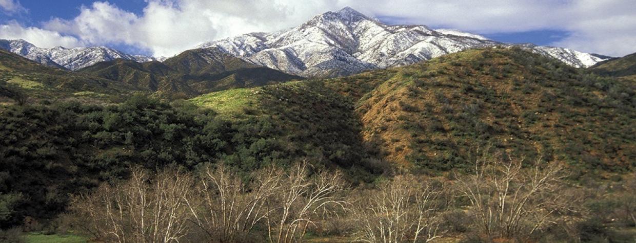
Four Peaks, Tonto National Forest
Most people in metropolitan Phoenix can point out the Four Peaks — it’s the most prominent landmark looking east, and collectively, the peaks mark the highest point in the Mazatzal Range. Few people, however, have any idea what the individual peaks are named. And there’s a reason for that: Three of the four summits aren’t named. Brown’s Peak, which is the highest (7,657 feet) and northernmost summit, is the only one with a name of its own. Fortunately, that won’t affect your ability to enjoy this hike. The only thing that’ll get between you and a perfect ending is the elevation gain of more than 3,700 feet.
The journey begins along Rock Creek on the east side of Four Peaks. For the first few minutes, the trail is ill-defined as you work your way across the creek and up a short, rocky slope. Cairns are in place to help you along, and before you know it, you’ll be on an old jeep road, marked as the Baldy Trail on USGS maps.
The Chillicut Trail follows the road for about 30 minutes, and it’s all uphill. Where the jeep road ends, the trail veers left and cuts across one of the many small canyons you’ll encounter before reaching Baldy Canyon, the main gorge on this trail. Although strenuous hikes require a certain determination and a plodding-on mentality, do yourself a favor and turn around from time to time. When you do, you’ll get some great views of the Mogollon Rim to the north and Roosevelt Lake to the east.
Moving on, about an hour into the hike, you’ll encounter a few creek-crossings and some ups and downs. The water, if there is any, won’t be an issue, and the inclines and declines vary in length — kind of like having your StairMaster set on “random.” The trail continues this way for about an hour, at which point you’ll come to a set of very steep switchbacks that lead into Baldy Canyon. There’s a creek in the canyon, and on the other side you’ll see a sign announcing the Four Peaks Wilderness Area. This kicks off the best part of the trail.
In addition to the stream, the canyon features cottonwoods, willows, sycamores and the kind of lush vegetation that’s typical of a riparian area, which provides habitat for the resident wildlife. Among the usual suspects are deer, skunks, javelinas, mountain lions and coyotes.
Heading upward, the trail bridges the creek several more times, the canyon narrows, the underbrush gets thicker and the trail gets a little harder to follow. It also gets steeper, and more than once you’ll equate the trail to the Energizer Bunny: It just keeps going and going and going. Eventually, though, you’ll pass Chillicut Spring and arrive at an intersection with the Four Peaks Trail, which also marks the summit of Buckhorn Mountain.
If, by this time, your legs and lungs haven’t already convinced you that you’ve made a long haul, the surrounding pine trees will. Their presence is what makes this hike unique. In a matter of miles, the Chillicut Trail goes from saguaros to ponderosas. It’s a little mind-boggling, and it’s a lot of work. Fortunately, it’s all downhill from there. And better yet, for peak-baggers anyway, the summit has a name — something to write in a journal. That’s not the case with three of the Four Peaks.
Length: 11 miles round-trip
Difficulty: Strenuous
Elevation: 2,852 to 6,582 feet
Directions: From Claypool (near Globe), drive north on State Route 188 for 36 miles to Forest Road 445 (Three Bar Road). Turn left onto FR 445 and drive 3 miles to Forest Road 445A. Turn left onto FR 445A and continue a quarter-mile to the trailhead.
Vehicle Requirements: High-clearance recommended
Dogs Allowed: Yes (on a leash)
USGS Map: Four Peaks
Information: Tonto Basin Ranger District, 928-467-3200 or www.fs.usda.gov/tonto

