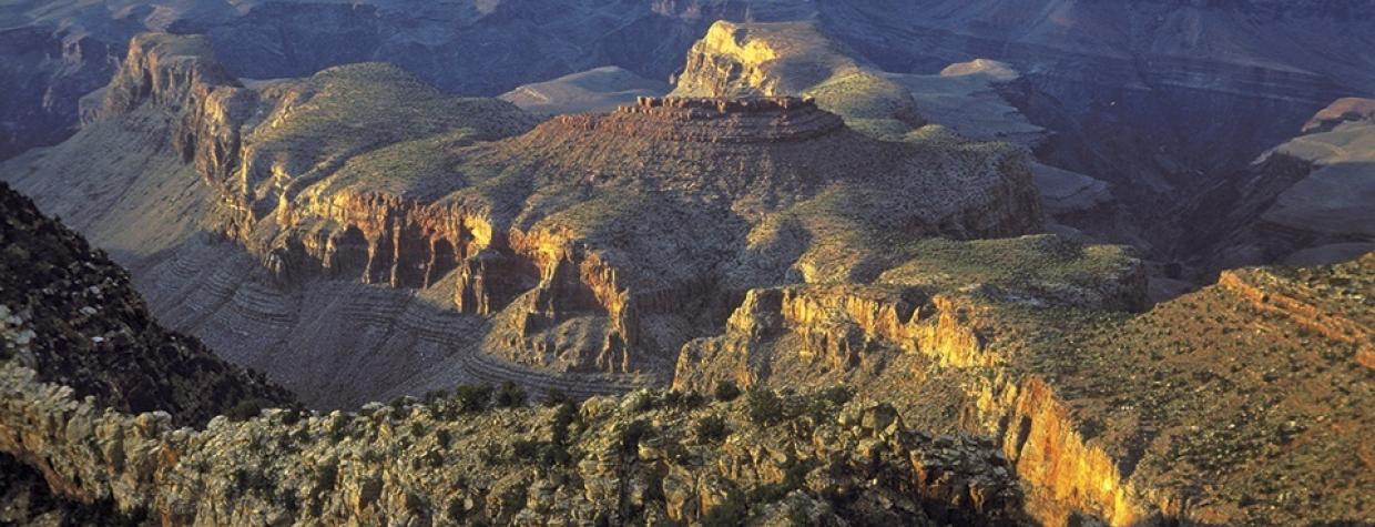
South Rim, Grand Canyon National Park
You could spend a lifetime hiking the Grand Canyon and never see it all. Most people don’t have that kind of time, so they tackle the Bright Angel Trail or one of the Kaibabs. Another great option is the Grandview Trail, which connects with the Tonto Trail and eventually drops all the way down to the Colorado River. Most hikers, however, go only as far as Horseshoe Mesa, which is the halfway point between the rim and the river, and that’s where this hike ends up.
The trail begins at Grandview Point, which, at 7,400 feet, is the highest point on the South Rim. Although the National Park Service doesn’t maintain the trail on a regular basis, it’s in good shape — especially since the upper switchbacks were repaired in 2005 after a massive rockslide destroyed several sections of the trail. Bottom line: You won’t have to worry about the trail, just your conditioning. In the short 3.1 miles to Horseshoe Mesa, the trail drops nearly 2,500 vertical feet, and the abrupt descent begins the instant you set foot on the trail.
Heading down, you’ll be exposed to the sun, except in a few pockets shaded by a handful of Douglas firs — they’re remnants of a forest that covered the area during the last Ice Age. After about 30 minutes, you’ll come to the Coconino Saddle, which rises up from the side canyons created by Hance and Cottonwood creeks. The saddle is shaded and makes a great place to sit and gaze. It’s also an ideal turnaround point for people not equipped to make the full run to the mesa.
Leaving the saddle, the trail takes a break from the descent, levels off for a few hundred yards, and cuts through a stand of trees. This is one of the best parts of the trail, but the level ground doesn’t last for long. Five minutes later, the steep descent begins again, and what you’ll notice is that going downhill can be very fatiguing. It almost makes you look forward to going up. Until you’re going up.
With the exception of some minor boulder-scrambling about an hour into the hike, the terrain remains the same. Then, after 31 switchbacks and the incineration of up to a thousand calories, you’ll arrive on the mesa. You’ll know you’re there when the views open up to your left and right — it’s a 270-degree panorama. Once you’re on the mesa, you’ll quickly come to an old tree wrapped with rusted barbed wire. It’s the first remnant you’ll see from the Last Chance Mine, which was developed in 1890 by Pete Berry and Ralph and Niles Cameron. You’ll also see old tin cans, fragments of copper ore (green malachite and blue azurite) and the red-rock ruins of an old cookhouse. There are several short spur trails, too. If your legs are willing, they’re worth exploring. However, keep in mind that the trip up is exponentially more difficult than the trip down. Like the Bright Angel Trail and the Kaibabs, the hike out will wipe you out. It’s worth it, though. That’s the nature of the Grand Canyon.
Length: 6.2 miles round-trip (to Horseshoe Mesa)
Difficulty: Strenuous
Elevation: 7,406 to 4,932 feet
Directions: From Grand Canyon Village on the South Rim, drive 12 miles east on East Rim Drive to Grandview Point. The trailhead is well marked.
Vehicle Requirements: None
Dogs Allowed: No
Horses Allowed: No
USGS Map: Grandview Point
Information: Backcountry Information Office, Grand Canyon National Park, 928-638-7888 or www.nps.gov/grca

