
Mingus Mountain
Widforss, West Baldy, the Inner Basin … some of the state’s best trails are best hiked in October, when the green of summer gives way to the red, yellow and orange of autumn. But in the same way that hummingbirds are drawn to the fiery red of flower blossoms, hordes of hikers are drawn to the forest this time of year. In the process, parking lots fill up, the woods get congested, and solitude moves on to another trail. One of its favorites is Gaddes Canyon. Despite its high elevation and parklike surroundings, it doesn’t attract a long queue of hikers. In fact, you might have it all to yourself.
The route begins at the edge of a primitive forest road on the southern end of the Mingus Mountain Recreation Area, a site that offers campgrounds, a small lake, a picnic area and a hang glider launch point. Another point of interest is the Mingus Mountain Lookout Tower. Built in 1935, it rises 60 feet above the mountaintop, which is located in what’s known as Arizona’s Transition Zone.
As the name suggests, it’s an area that’s situated between two others — the Sonoran Desert to the south and the Colorado Plateau to the north. The vegetation of the zone is a mix of what’s found next door, including cactuses, yuccas and agaves from the south, and oaks, walnuts and ponderosas from the north. It’s the oaks and walnuts that’ll be showing off their colors this month.
From the trailhead, the route heads southeast through an open forest of pines and junipers that punctuate a carpet of native grasses. It’s not unusual to see mule deer surveying the landscape. Or elk. There’s also a set of power lines a few minutes in, but they’re the hike’s only sign of civilization, other than a couple of forest roads later on.
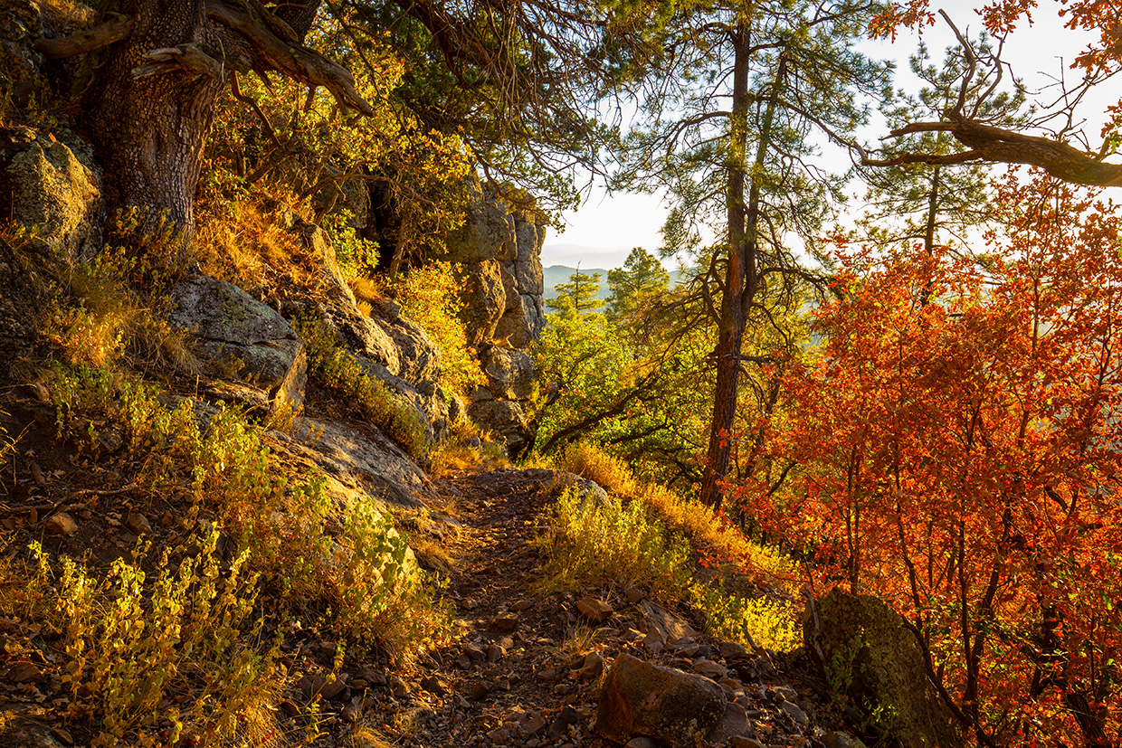
Meantime, the trail shifts west, passes through a fence and begins a gradual descent that leads to your first glimpse of the northern end of Gaddes Canyon, which is deep and rugged and funnels wind to the trail above. This stretch is particularly appealing to mountain bikers and horseback riders. If you happen to cross paths with either, keep in mind that hikers yield to horses, bikers yield to hikers and horses, and horses yield to no one. They have the right of way.
Continuing on, the route shifts again. This time south past Gaddes Spring and into the canyon. A few switchbacks later, you’ll touch the bottom and come to an intersection with Trail No. 9037 (the Gaddes Two Trail), which follows the lush, shady bottom of Gaddes Canyon for a couple of miles to the southeast. The canopy created by the ancient ponderosas, oaks and walnuts makes this a cool alternative in the summer.
From the intersection, continue straight on as the trail climbs back out of the canyon. The track is rocky through here, so watch your ankles. Back on top, you’ll see a forest road that comes in from the right. Veer left. The trail is well marked at this point, but that’s not the case up ahead.
Just past a point that offers nice views toward Camp Verde in the southeast, an unmarked trail veers right. It’s about 30 minutes into the hike. A conscientious hiker recently added a small cairn, but there’s no guarantee it’ll be there, so you’ll have to watch closely. If you miss the turn, you’ll end up at a dead end. The views out there are spectacular, but it’s not where you’re meant to be. Ironically, a few hundred feet down the unmarked trail, out of sight from the intersection, is a narrow sign that identifies the route as Trail No. 110 — the Gaddes Canyon Trail.
Beyond the sign, about 45 minutes into the hike, the trail starts to switch downhill toward Burnt Canyon. Most of this hike’s elevation change happens in this final stretch, which ends at a nondescript trailhead along Forest Road 413 (Allen Springs Road). Unlike Widforss and West Baldy, there’s no payoff at the end, but there is a good chance you’ll have the place all to yourself. And this time of year, that means something.
Length: 4.96 miles round-trip
Difficulty: Moderate
Elevation: 7,669 to 6,671 feet
Trailhead GPS: N 34˚41.644', W 112˚07.556'
Directions: From Jerome, go south on State Route 89A for 7.6 miles to Forest Road 104 at Mingus Pass (elevation: 7,023 feet). Turn left onto FR 104 and continue 2.3 miles to Forest Road 104B at the Mingus Mountain Recreation Area. Turn right onto FR 104B and continue 0.2 miles to the trailhead on the left.
Vehicle Requirements: A high-clearance vehicle, such as an SUV or truck, is recommended on Forest Road 104B.
Dogs Allowed: Yes (on a leash)
Horses Allowed: Yes, but it’s not suitable for horses in wet weather.
USGS Maps: Hickey Mountain, Cottonwood
Information: Verde Ranger District, 928-567-4121 or fs.usda.gov/prescott