Pleasant Valley Ranger District
If you need some time alone, then Hell’s Hole is where you want to be. Although it sounds ironic that any part of hell is a better option than wherever it is you might be coming from, in this case, it is. If ever there was a place that’s off the grid, Hell’s Hole is it.
From the trailhead, which is located under the tall pines of the Reynolds Creek Campground, the route begins a gradual uphill climb through the trees. Because the high end of the trail sits about a mile above sea level, snow is possible this time of year. As with any trail, it’s always best to call ahead and check on conditions.
About 15 minutes in, you’ll come to an impressive alligator juniper, followed by an equally impressive manzanita. Beyond them, the trail begins a downhill stretch through a thick forest of ponderosa pines and Douglas firs. Unlike some of the pine forests in other parts of the state, including those around the South Rim of the Grand Canyon, the ground cover here is especially thick. And especially beautiful. Also, at this point, the trail is well marked and easy to follow. By the end of the hike, things will be different.
Not to be outdone by the impressive juniper and manzanita, one of the largest ponderosas you’ll ever see grabs your attention at the 30-minute mark. There are more pines as you move along, but none quite like this. Eventually, the evergreens will give way to scrub oaks and piñons, and the views will open up and give you a good sense of just how rugged the Salome Wilderness is. As you make your way north, you’ll start hearing the sounds of Workman Creek. You won’t see it, not yet, but you will hear it. Like Salome Creek, which runs east-west through the entire wilderness area, Workman Creek is a perennial stream that supports a decent population of brown trout and rainbow trout. The fish, in turn, serve as main entrées for some of the area’s wildlife, which includes bobcats, badgers, ringtails and coyotes.
After an hour, you’ll arrive at the water. The riparian nature of Workman Creek makes it a great place to gear up for the rest of the hike and the descent into Hell’s Hole. But first, you’ll officially cross into the Salome Wilderness and begin a lengthy uphill climb. Along the way you’ll pass an intersection with the Boyer Trail, the only other established trail in the wilderness. Veer right to stay on the Hell’s Hole Trail, which crosses a muddy mesa that leads to the brutal switchbacks that will take you into the trail’s namesake. Not only are the switchbacks steep, and more challenging on the way out, but they’re also overgrown with prickly brush, making it difficult to find your way. You don’t have to be Magellan to navigate the mess, but you do have to pay attention. Sometimes when you think you’re supposed to go right, you need to go left. And vice versa. The bushwhacking is worth it, though.
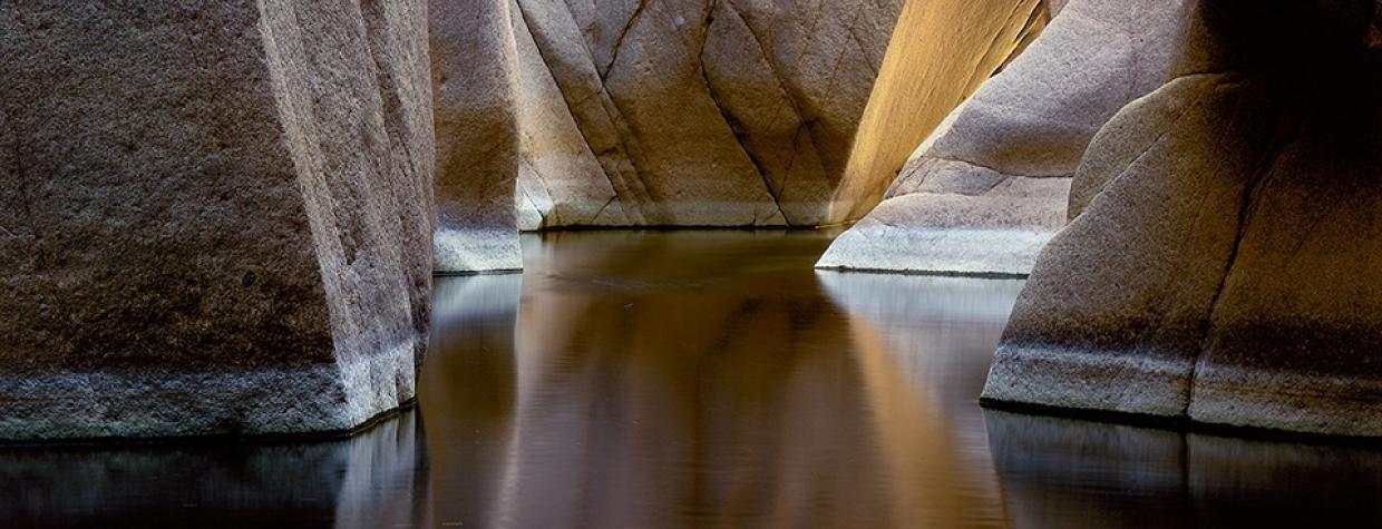
By the time you get to the end of the trail, after almost three hours of hiking, you’ll be greeted once again by Workman Creek. This time, though, it’s in a deep canyon and the waterway is flooded with large boulders, many of which are as big as Barcaloungers. There’s no guarantee you won’t run into other people at the bottom, but it’s unlikely. And if you do, they’ll likely be like-minded — it takes a special hiker to hike into a place called Hell’s Hole.
Length: 12 miles round-trip
Difficulty: Strenuous
Elevation: 4,389 to 5,226 feet
Trailhead GPS: N 33˚52.262', W 110˚58.511'
Directions: From Claypool, go north on State Route 88
for approximately 15 miles to its junction with State Route 288. Bear right onto SR 288 and continue 27 miles to the trailhead at Reynolds Creek Campground.
Vehicle Requirements: None
Dogs Allowed: Yes (on a leash)
Horses Allowed: Yes
USGS Maps: Armer Mountain, Copper Mountain, McFadden Peak
Information: Pleasant Valley Ranger District, 928-462-4300 or www.fs.usda.gov/tonto

