
Prescott National Forest, Prescott
The origin of the word “wilderness” is wildeornes, which comes from wild deor (“wild deer” + ness). In a broader sense, it means “land inhabited only by wild animals.” For visionaries like Aldo Leopold and Arthur Carhart, the notion of such a place was so important they laid the groundwork for what would eventually become the Wilderness Act, a law that protects nearly 110 million acres across the nation, including 7,566 rugged acres about an hour north of Prescott.
In keeping with the etymology of the word, the Juniper Mesa Wilderness is home to deer and other wild animals — elk, black bears, bobcats, Abert’s squirrels. There are junipers, too, but what stands out most is Juniper Mesa, a flat-topped mountain of limestone surrounded by a landscape of granite boulders and broken pieces. The mesa, which is interrupted in places by small canyons, ranges in elevation from 7,050 feet on the west side near Gobbler Knob to 5,650 feet at Juniper Spring on the east side. The spring is where you’ll be headed on this hike.
From the trailhead, the route begins as a wide, rocky path hemmed in by the junipers for which the wilderness is named. Technically, the wilderness area doesn’t begin for another mile, but the junipers — Utah and alligator — are everywhere. And mixed among them, along the way, are piñons, ponderosa pines, cliffroses, mountain mahogany, prickly pears and agaves.
Early on, the trail dips into a wash. Not far from there, you’ll see a wooden sign that indicates Juniper Spring is 3.5 miles ahead. It’s not. As a general rule, the Prescott National Forest does an excellent job of marking its trails, but this one is wrong. The actual distance is about 2.5 miles. Don’t be confused.
Just beyond the wash, you’ll pass through a barbed-wire fence and come to an intersection with the Old Military Trail, a route that was used by the U.S. Army during the Hualapai War in the 1860s. Veer left to stay on the Juniper Springs Trail, and keep your eyes peeled for pronghorns, which roam the rolling hills of the Juniper Mountains. If you don’t see one of those, you will get a nice look at the big mesa to the northwest.
Continuing up the southeast flank, you’ll pass some ancient alligator junipers and a few small ponderosas. The grade is gentle at this point as it winds through a rolling terrain of scattered granite boulders. There are walls of granite, too, similar to what you see at Watson Lake.
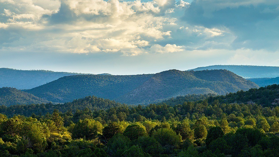
After a half-hour of climbing, the trail starts getting a little steeper. And with the ascent come some amazing views of the San Francisco Peaks to the northeast. There are photo ops in the other direction, too. Looking south you can see the idyllic setting of the Walnut Creek Center for Education and Research. The site was established by the Prescott National Forest to serve as a district ranger station in 1909. Today, it’s operated through a partnership of Prescott College, Northern Arizona University and the Arboretum at Flagstaff. Beyond the center, you’ll see Granite Mountain and the Sycamore Canyon Wilderness.
Enjoy the views and continue another 10 minutes to the boundary of the Juniper Mesa Wilderness. The trail levels off briefly, and then starts climbing again, this time through a small boulder field. As you get to what you’ll think is the top, you’ll see the most impressive gator of the day. It’s a gathering spot for mule deer. About 10 minutes later, you’ll come to the high point of the trail (6,271 feet) and a nice grove of trees. From there, the route begins a slight downhill run through a thick forest of junipers.
Things stay about the same until you reach an intersection with the Juniper Mesa Trail — the east-west thoroughfare of the wilderness. To the right is Juniper Spring, which feeds the trees and grasses that make the area an oasis that’s attracted settlers for more than a century. Remnants of their efforts include an old corrugated corral and some rusted water troughs. The old steel, which predates the area’s wilderness designation, is a reminder of what Aldo Leopold and Arthur Carhart were trying to protect against. Nevertheless, you still might see wild deer on Juniper Mesa.
Length: 5.8 miles round-trip
Difficulty: Moderate
Elevation: 5,169 to 6,271 feet
Trailhead GPS: N 34˚55.599', W 112˚50.535'
Directions: From Prescott, go north on Williamson Valley Road for 35.7 miles to County Road 125 (after 22 miles, the road turns to dirt). Turn left onto CR 125 and continue 1.4 miles to the trailhead on the right.
Vehicle Requirements: None
Dogs Allowed: Yes (on a leash)
Horses Allowed: Yes
USGS Map: Indian Peak
Information: Chino Valley Ranger District, 928-777-2200 or www.fs.usda.gov/prescott; Walnut Creek Center for Education and Research, 928-445-3831