
Coronado National Forest, Tucson
As backyard playgrounds go, Tucson might have every other city beat. To the east and west are the two districts of Saguaro National Park, and to the north is Sabino Canyon. There’s adventure to the south, too, but it’s not as simple. In the other three directions, Mother Nature rubs elbows with the city limits. The flip side to that proximity is overcrowding, but if you know where to look, you can usually find some breathing room.
In Sabino Canyon, the locals tend to hit the Blackett’s Ridge Trail. There’s no guarantee of solitude along the way, but it’s much quieter than the expressway to Seven Falls or the short loops around the visitors center. To get there, though, you will have to jostle a bit at the outset. Like other routes in the recreation area, the Blackett’s Ridge Trail is accessed by a series of connecting trails, including the heavily trafficked pathway that heads east from the restroom at the visitors center.
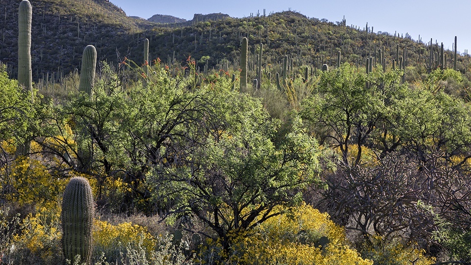
Technically, that path is the beginning of the Bear Canyon Trail, but the name’s not important. Instead, watch for the signs that point to the Phoneline Trail. That’s where you’re headed first. Within minutes, you’ll be amid the Sonoran landscape that makes this place so special. Saguaros. Paloverdes. Chollas. Prickly Pears. Mesquites. Ten minutes later, you’ll come to one of the park’s paved roads. Veer right. The trail parallels the road and then drops into an unexpected riparian wash.
On the other side, you’ll come to another park road. This time, hop across, hike about 100 yards, and then turn right onto the Phoneline Trail. To this point, the trail has been mostly horizontal, but this is where it starts to climb. That’s significant because the rest of the route is only 2.2 miles, and in that short distance, you’ll ascend almost 2,000 feet. Those numbers tend to thin out the crowds.
Although the hiking gets harder, the huffing and puffing is mitigated by the beauty of the desert, which is especially lush in this area. The hillside is covered with familiar and unfamiliar plant species. And in March, it’s sprinkled with the colors of Mexican goldpoppies, brittlebushes and other desert wildflowers. But any time of year, this stretch is stunning.
Moving on, after a half-hour of overall hiking, you’ll arrive at an intersection with the Blackett’s Ridge Trail. This is where the serious ascent begins. But before you take off, take a look around. There are some great views of Tucson to the south and the Rincon Mountains to the east.
From the intersection, turn right onto the Blackett’s Ridge Trail. After 10 minutes, you’ll come to the first switchback. After that, they keep coming. And getting steeper. It’s like setting your elliptical machine on “random.” The workout continues for about 20 minutes until you reach a point that overlooks Sabino Canyon. A few minutes later, the trail levels off briefly and enters the Pusch Ridge Wilderness. Looking ahead, you’ll see what you’ll think is the summit. (Spoiler alert: It’s not.)
Take a deep breath and start climbing again. This time, though, there are no switchbacks. It’s straight up to the false summit you saw from below. Once you finally get there, the trail dips slightly downhill and levels off again. As you head along the ridge into the homestretch, the canyons on either side start closing in, and you’ll get a sense that you’re running out of real estate. Then, you’ll see a steel sign that confirms your instincts. “End of the Blackett’s Ridge Trail,” it reads.
Just beyond those words is a rock ledge that insists you sit down. To the east is Bear Canyon; to the west, Sabino. Collectively, the panorama is one of the best in Tucson’s backyard. You can even hear the trickling sounds of Sabino Creek a few thousand feet below. It’s enough to make you think you’re in the middle of nowhere, even though you’re just beyond the city limits of Tucson.
Length: 6 miles round-trip
Difficulty: Strenuous
Elevation: 2,725 to 4,409 feet
Trailhead GPS: N 32˚20.627', W 110˚46.830'
Directions: From Tucson, go east on Tanque Verde Road to Sabino Canyon Road. Turn left onto Sabino Canyon Road and continue 4 miles to the Sabino Canyon Recreation Area visitors center, which is open from 8:30 a.m. to 4 p.m. daily.
Special Consideration: A $5 day pass is required.
Vehicle Requirements: None
Dogs Allowed: No
Horses Allowed: Not suitable for horses.
USGS Map: Sabino Canyon
Information: Santa Catalina Ranger District, 520-749-8700 or www.fs.usda.gov/coronado