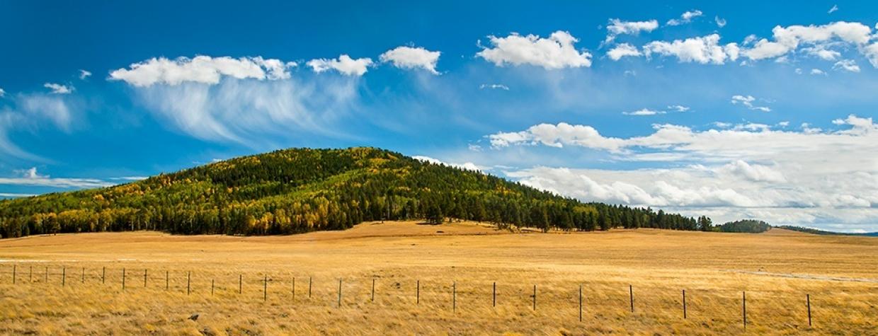
Apache-Sitgreaves National Forest, Greer
Most trails are named for canyons, creeks and mountaintops, and some are named for people. This one gets its name from Pole Knoll, the small, round hill where it’s located. The “knoll” can be seen for miles, but the “pole” isn’t so obvious, unless you’re out there in the middle of winter. That’s when Pole Knoll Recreation Area becomes a mecca for cross-country skiers. Skiers, of course, carry poles, but so do a lot of hikers, which is why you’re reading about this place in October.
In all, there are nearly 18 miles of interconnected trails in the recreation area. Many are short and easy, but the Viewpoint Trail (1.3 miles one way) and the Summit Trail (2.1 miles one way) climb almost 800 feet to the top of the hill, where the views of the surrounding White Mountains are worth the energy it takes to get there. Otherwise, the rest of the routes are easy, and easy to follow.
The trails — there’s a maze of 12 — are well marked with their respective names, as well as with internationally recognized Nordic ski symbols: A green circle means an easy trail; a blue square indicates a moderately difficult trail; and a black diamond is the most difficult. If you gauge your hikes by elevation gain, the Pole Knoll Trail is easy — it’s mostly level as it orbits the hill. However, the U.S. Forest Service gives it a blue square, probably because trekking 6.2 miles at an elevation of 9,000 feet is noticeable, even for people who can touch their toes.
From the trailhead, which can accommodate horse trailers, the loop heads clockwise through an open forest of ponderosa pines and quaking aspens. The fall color is spectacular on the knoll, and the autumn air is always crisp. About 10 minutes in, you’ll intersect the Raven Trail — it’s the first of many intersections. The second is the Meadow Lark Loop. If you’re short on time, this is a quick 2.1-mile hike. Moving on, you’ll pass the southern end of the Raven Trail and the Pine Jay Trail. You’ll also see a gorgeous meadow to the east — look for elk and mule deer at dawn and dusk.
After an hour of ambling (that’s what you do on this trail), you’ll see the ski slopes of Sunrise Park Resort to the south, and another big meadow in between. The elevation at this point is 9,186 feet, a whopping 181 feet above where you started. But it’s the high point of the hike. It’s all “downhill” from there.
Continuing southwest, you’ll come to the only tricky part of the trail. Intuitively, you’ll think you’re headed to Forest Road 112, which is clearly visible up ahead. The trail, however, angles right, a few hundred yards short of the road. It’s tough to find, and once you’re on it, it’s a little tough to follow. But you have options. You can either bushwhack across the rocky meadow — if you can find the trail — or take the forest road and rejoin the trail 15 minutes later. As long as you keep moving clockwise, you’ll eventually see the trail farther west in a well-marked meadow. The trail skirts the edge of the long grass and then dips into the woods. Listen for mountain bluebirds. Their sounds lead the way.
Ten minutes later, the trail splits. An easier version of the Pole Knoll Trail veers left, and the main route, which is slightly steeper, goes the other way. The two routes reconnect a half-mile later at the trailhead, where you’ll see hikers and mountain bikers for a few more weeks. It won’t be long, though, before the skiers start rolling in — winter comes early in the White Mountains.
Length: 6.2-mile loop (Pole Knoll Trail only)
Difficulty: Moderate
Elevation: 9,005 to 9,186 feet
Trailhead GPS: N 34˚03.268’, W 109˚30.216’
Directions: From Greer, go north on State Route 373 for 4.9 miles to State Route 260. Turn left onto SR 260 and continue 2.4 miles to Forest Road 112. Turn left onto FR 112 and continue a quarter-mile to Pole Knoll Recreation Area.
Vehicle Requirements: None
Dogs Allowed: Yes (on a leash)
Horses Allowed: Yes
USGS Map: Greens Peak
Information: Springerville Ranger District, 928-333-6200 or www.fs.usda.gov/asnf

