
Tonto National Forest, Pine
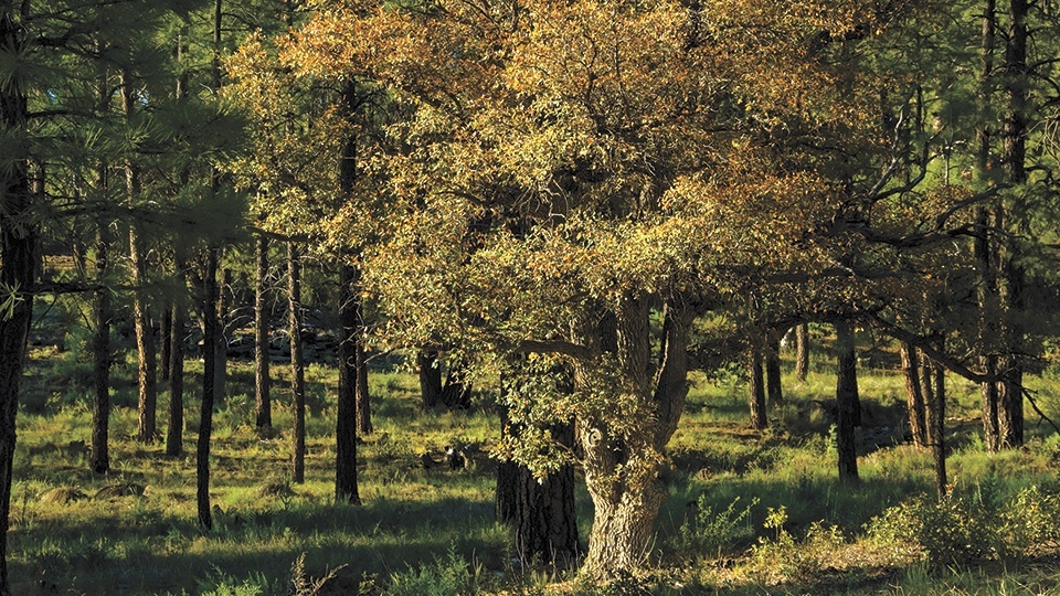
Unlike For What It’s Worth, the Buffalo Springfield hit that doesn’t include the song title in its lyrics, there’s an obvious reason for the name of this trail. Oaks are the main attraction, especially toward the end of the trail, where they shade Oak Spring, a life-giving little trickle that helps nourish the canyon of the same name. Oaks are everywhere. Specifically, Arizona white oaks, which are medium-sized evergreens with stout branches. They rank as one of the largest oaks in the Southwest, and they thrive in deep, moist canyons. Thus the big boys in Oak Spring Canyon.
In addition to its impressive hardwoods, the Oak Trail is part of the Arizona Trail, an 819-mile route that runs the length of the state from Utah to Mexico. Although it’s not the most popular section of the National Scenic Trail, it offers a great introduction to the ecosystem below the Mogollon Rim.
The route begins at the Pine Trailhead, a spacious staging area located just south of the little town of Pine. From the parking area, look for the trail sign toward the southwest corner of the lot. That’s where you’ll begin. It’s important to note that most of the literature for this hike identifies it as a 5-mile round-tripper, but there’s also a half-mile trek from the Pine Trailhead to where the Oak Trail officially kicks off on the west side of State Route 87.
Use caution when crossing the highway, and look for the sign that reads, “Oak Spring Trail 16.” About 10 minutes later, the trail gets wider and heads northwest to a small ranch on private property. The trail veers around the ranch and crosses the creek, which can run heavily in the springtime, depending on the level of snowmelt. From the waterline, the trail climbs gradually out of a small valley toward a revegetation area, which is recovering from a fire that burned several years ago. Although you can still see the trail that cuts through the burn area, veer left onto an alternate trail that leads down to a small wetland that’s sprinkled with some interesting boulders.
You’ll cross some of the rocks, and maybe a few fallen trees, before topping out again at Bradshaw Tank, which is surrounded by young pines and junipers. As you’ll see, the fire took out a lot of trees, making the area open and sunny. Unless it’s cloudy, of course.
About an hour into the hike, the forest starts to thicken and the oaks start appearing. In addition to the oaks, take note of the views over your left shoulder. In the winter, you might see snow on the high ridges across The Narrows, a nearby canyon carved by Pine Creek.
From this point, the trail begins its general descent toward Oak Spring Canyon. The vegetation is thicker and includes some hearty agaves. Also, the views to the southeast are even better than they were before. What you’ll notice most, however, are the downhill switchbacks. They’re not as steep as those on the Grandview Trail in the Grand Canyon, but you will feel the burn as the trail drops nearly 700 feet to the canyon bottom.
Although there won’t be running water in the canyon, you will see the effects of the nearby spring. You’ll also see an intersection with the Walnut Trail. When you get there, turn left and continue about 200 yards to a sign for Oak Spring. The spring itself is another 200 feet downhill. Like most springs, this one doesn’t make a lot of noise, but it’s quietly powerful, serving as a lifeline to some massive Arizona white oaks. Looking around, it’s easy to see how this trail got its name. The trees are impressive. Also, for what it’s worth, there’s a gorgeous meadow nearby. It’s the perfect place to chill out, grab a snack and admire the mighty oaks.
Length: 6 miles round-trip
Difficulty: Moderate
Elevation: 5,417 to 5,074 feet
Trailhead GPS: N 34˚22.445´, W 111˚26.606´
Directions: From Payson, go north on State Route 87 for 15 miles to the Pine Trailhead, which is on the east side of the highway.
Vehicle Requirements: None
Dogs Allowed: Yes
Horses Allowed: Yes
USGS Maps: Pine, Buckhead Mesa
Information: Payson Ranger District, 928-474-7900 or www.fs.usda.gov/tonto