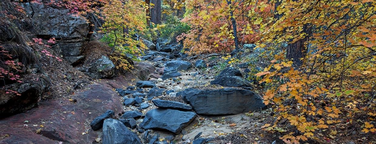
Coconino National Forest, Sedona
Bear Canyon, Bear Creek, Bear Wallow ... there are many places in Arizona that have the noun “bear” in their names. In some cases, something about the place resembles a bear — a rock or a mountain. In others, it’s a family name. And then there are those places where pioneers either shot a bear, wrestled a bear or saw a bear. Bear Sign Canyon is on that list. It’s bear country, and if you hike into the depths of the canyon, there’s a decent chance you’ll see one of the large, heavy mammals with long, shaggy hair. Footprints and bear scat are everywhere. But first, you have to get to the trailhead.
Mother Nature has a way of building moats. Although a few great trails in Red Rock Country — West Fork and Brins Mesa — are easy to get to, one of the best is not. To get to the Bear Sign Trail, you have to overcome Forest Road 152. Where it splits from the pavement, there’s a good-sized parking area, well suited to sedans.However, to go beyond that, you’ll need a four-wheel-drive with high clearance. That’s non-negotiable. If your ride measures up, the trailhead is about 4 miles ahead. If it doesn’t, you could walk those miles instead, and make an otherwise moderate day hike into something more substantial. Either way, it’ll take some effort — by definition, moats are meant to be a deterrent.
When you finally get to the trailhead, you’ll see that the Bear Sign Trail parallels the Dry Creek Trail for the first three-quarters of a mile. Look left and head north. The route immediately passes into the 43,950-acre Red Rock-Secret Mountain Wilderness, where, in addition to bears, you might see badgers, bobcats, mule deer and mountain lions. At the outset, the single track is red dirt and lined with alligator junipers, manzanitas and agaves. Within a few minutes, it moves from open air into the woods. And it’ll stay that way for most of the route — the shade makes this hike a year-round option.
As you make your way, look down and around for bear tracks. And beware of the scat. Because this trail is extremely remote and gets very little human traffic, the local bear population uses it as a thoroughfare.
About 10 minutes in, the trail crosses Dry Creek Wash. It’s the first of several “creek” crossings. Surprisingly, there aren’t many cairns in the canyon, which makes the dry, rock-lined crossings a little confusing. The best approach is to pause on the bank, look for the trail on the other side, and then move on.
Once across, the route ascends to a small rise with some nice panoramas of the red rocks, before dropping back down to the wash, which at this point is sheltered by Arizona sycamores — in the fall, they add a splash of golden orange to the already colorful palette. You’ll make another crossing here, and it’s confusing, because the route follows the rocky bottom of the wash for about 50 yards to the left before reconnecting with the trail on the opposite side. After another back-and-forth, you’ll come to an intersection with the Bear Sign Trail. The Dry Creek Trail goes right. You’ll go left as the route climbs out of the wash and into the woods. Tall, skinny junipers predominate, with a mix of young ponderosas and sycamores.
After yet another creek crossing, the trail veers away from the wash and begins a gradual climb through a thicket of oaks and larger ponderosas. You’ll start seeing some firs as well. For the next 2 miles, things remain the same as the canyon narrows and the trail winds to an intersection with the David Miller Trail. This is the suggested turnaround point. Although the trail continues for another mile into Bear Sign Canyon, the route all but disappears. If you’re up for the challenge, keep track of the creek bed and keep your eyes peeled for bears. This is one of the most remote areas of the Red Rock-Secret Mountain Wilderness. And even if you don’t see a large, heavy mammal with long, shaggy hair, you can rest assured they’re out there. This is bear country.
Length: 5.7 miles round-trip (to the David Miller Trail)
Difficulty: Moderate
Elevation: 4,813 to 5,330 feet
Trailhead GPS: N 34˚56.235', W 111˚47.659'
Directions: From the roundabout intersection of State Route 179 and State Route 89A in Sedona, go southwest on SR 89A for approximately 3.1 miles to Dry Creek Road. Turn right onto Dry Creek Road and continue 1.9 miles to Forest Road 152. Turn right onto FR 152 and continue 4.17 miles to the trailhead.
Special Consideration: A $5 day pass is required.
Vehicle Requirements: A high-clearance, four-wheel-drive vehicle is required.
Dogs Allowed: Yes (on a leash)
Horses Allowed: Yes
USGS Map: Wilson Mountain
Information: Red Rock Ranger District, 928-282-4119 or fs.usda.gov/coconino

