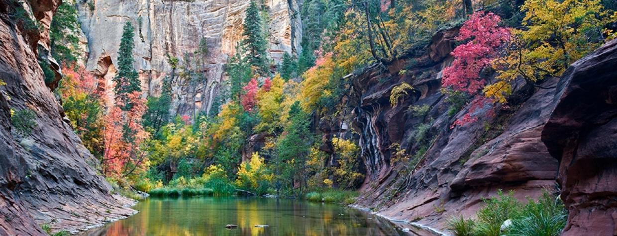
Coconino National Forest, Sedona
If you’re looking for isolation, this hike won’t deliver. On weekends and holidays, especially in the spring and fall, literally hundreds of people will be in your way. However, in the same way you don’t avoid the Grand Canyon just because 6 million people a year visit the park, you don’t want to leave the West Fork of Oak Creek off your list.
There are several reasons this is the most popular trail in the Coconino National Forest: the towering cliffs of Coconino Sandstone, the Douglas firs and box elders and bigtooth maples, the perennial stream, the wild grapes and asters and lupines, the mule deer and Abert’s squirrels, and the list goes on. The combination inspired the federal government to designate Oak Creek Canyon’s first 6 miles, including this trail, a Research Natural Area in 1931. The ecosystem is extraordinary, which is why people from around the world flock to this trail.
The hike begins at the Call of the Canyon Picnic Site, which is conveniently located just off State Route 89A in Oak Creek Canyon. In addition to West Fork, the fee area also serves as a starting point for the Thomas Point Trail and the Call of the Canyon Nature Trail. In fact, you’ll be taking the nature trail for a quarter-mile out to the trailhead for West Fork. Just before you get there, you’ll pass an old settlement that includes remnants of fireplaces, stone floors and a cliff house. They’re leftovers from the Mayhew Lodge, a classic inn with colorful history. In its heyday, the lodge was a favorite getaway of movie stars, politicians and writers, including the Earl of Halifax, President Herbert Hoover, Clark Gable, Susan Hayward, Cesar Romero and Jimmy Stewart. If this were private property today, you couldn’t put a price on it. Fortunately, it’s public, and it’s the last set of man-made structures you’ll see.
Although the West Fork Trail is rated as “easy,” it does include several creek crossings that require a little agility and a willingness to get your feet wet. There are steppingstones or logs in most places, but there are no guarantees of keeping dry. The first of the many crossings occurs within a few minutes after leaving the trailhead. After that, they show up regularly. As alluring as the water is, it’s the red rocks that’ll take your breath away. Hiking this trail is akin to walking in Manhattan for the first time. You’ll be craning your neck a lot. Captivated. Later on, when you’re looking through your photos, you’ll notice that many of them were taken with the camera pointed upward.
The route continues along this same basic path — water, woods and natural wonder — for about 45 minutes, at which point the trail veers 90 degrees to the left. As you make your way through the canyon, you’ll notice some alternate paths from time to time. It can be mildly confusing, but if you choose the trail closest to the creek, you’ll be OK.
A few minutes after the sharp turn, you’ll come to an area where a rockfall occurred, and just beyond that, the canyon opens up a little. To this point, the trail has been well marked and easy to follow. Beyond this point, the canyon is narrower and overgrown with vegetation.
The homestretch begins amid some dead trees that look as if they’re lodged in place forever. The trail is hard to find, but if you look to your left, you’ll see where it climbs up the canyon wall and away from the water before dropping back down again about 10 minutes later. Just beyond that, a decent-sized pool marks the end of the trail. This is the turnaround point for day hikers. However, you might see some backpackers who will keep on trekking. For them, the creek continues for 14 miles to the other end of the canyon. For everyone else, it’s time to turn back and enjoy the return on one of Arizona’s best hikes. You won’t be the only one on the trail, but it won’t matter. This trail is that good.
Length: 6.75 miles round-trip (from parking area)
Difficulty: Easy
Elevation: 5,316 to 5,565 feet
Trailhead GPS: N 34˚59.434', W 111˚44.587'
Directions: From Sedona, go north on State Route 89A for 9.5 miles to the Call of the Canyon Picnic Site.
Special Consideration: The U.S. Forest Service requires a fee of $11 per vehicle (up to five people) in the Call of the Canyon Picnic Site.
Vehicle Requirements: None
Dogs Allowed: Yes (on a leash)
Horses Allowed: No
USGS Maps: Dutton Hill, Wilson Mountain, Munds Park
Information: Red Rock Ranger District, 928-282-4119 or fs.usda.gov/coconino

