
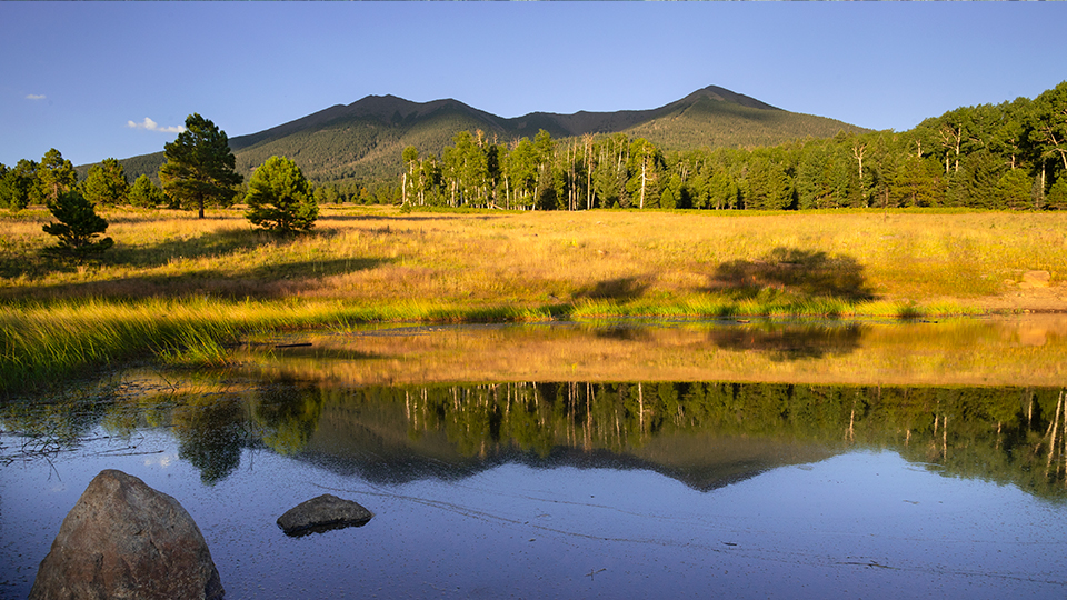
Coconino National Forest, Flagstaff
“Few are altogether deaf to the preaching of pine trees. Their sermons on the mountains go to our hearts; and if people in general could be got into the woods, even for once, to hear the trees speak for themselves, all difficulties in the way of forest preservation would vanish.”
John Muir, the renowned conservationist who wrote those words in January 1896, had strong convictions about the persuasive nature of Mother Nature. Although he never set foot on the San Francisco Peaks segment of the Arizona Trail — it wasn’t even conceived until a century after his quote — he would have loved it for its accessibility. After all, the more people you can get into the woods, the better, and this trail makes it easy. If you can walk across the street, you can probably handle this hike — or at least part of it. Put it on your list, and when you go, listen to the pine trees. The aspens and the ferns might have something to say as well.
The San Francisco Peaks segment of the impressive Arizona Trail is Passage 34 — in all, there are 43 passages that make up the 819-mile trail. If you were to hike the entire Peaks segment from Schultz Pass to Cedar Ranch, you’d rack up 32.3 miles. Every mile is worthwhile, but this listing, which is unofficially dubbed the “San Francisco Peaks Trail,” covers only a segment of the segment, from Aspen Corner to Forest Road 418. While you’re enjoying the scenery, keep in mind that the trail you’re hiking comes courtesy of the Arizona Trail Association. Its volunteers do remarkable work. And this beautiful segment, which was completed in July 2009, is no exception.
The trail begins at Aspen Corner, about three-quarters of the way up Snowbowl Road. The site is distinguished by a lush meadow surrounded by aspens, and the meadow is separated from the small parking area by a wooden-rail fence. It’s on the left. You can’t miss it. For the first 15 minutes, the trail winds through a thick forest of pines and aspens. That’s what the majority of the hike is like, but one of the exceptions comes before you even work up a sweat. About a quarter-mile in, the trail goes from the woods to a vast meadow, beyond which are some classic views of the San Francisco Peaks. On most hikes in Arizona, the mountains take center stage. They’re a big part of this trail, too, but it’s the greens of the grasses and the ferns and the aspen leaves and Muir’s pine trees that stand out most. It’s enough to make you think you took a wrong turn and somehow ended up in Olympic National Park.
Back in the woods, the terrain and the elevation remain constant. And so does the scenic beauty. It goes from gorgeous to gorgeous to gorgeous. Everywhere you look, you’re going to see something you want in your camera, including a gnarly old ponderosa about halfway in that ranks as one of the oldest and largest pine trees on the trail. If you’re going to heed Muir’s advice, this is the tree to listen to.
From there, the trail continues to the turnaround point at Forest Road 418. In the vicinity, there are some downed aspens surrounded by tall, green grass. The trees make perfect benches for parking your butt and resting your legs. Although this trail is rated easy, it still requires 15 miles of hiking at an elevation of around 9,000 feet. You’ll be worn out by the time you get back, but if you were paying attention along the way, you’ll have grown more than just tired. On this trail in particular, it seems unlikely that John Muir could have been wrong.
Length: 15 miles round-trip (to Forest Road 418)
Difficulty: Easy
Elevation: 8,928 to 9,000 feet
Trailhead GPS: N 35˚19.177', W 111˚43.219'
Directions: From Flagstaff, go north on U.S. Route 180 for 7 miles to Forest Road 516 (Snowbowl Road). Turn right onto FR 516 and continue 5.1 miles to the Aspen Corner parking area, on the left.
Vehicle Requirements: None
Dogs Allowed: Yes (on a leash)
Horses Allowed: Yes
USGS Map: Humphreys Peak
Information: Flagstaff Ranger District, 928-526-0866 or fs.usda.gov/coconino