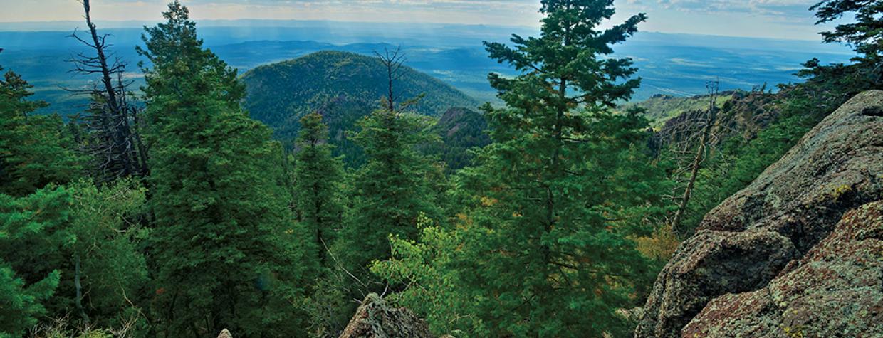
Kaibab National Forest, Williams
Bill Williams was a mountain man, an intrepid explorer cut from the same cloth as Jim Bridger, John Colter and Zebulon Pike. If you’re not familiar with any of those grizzled pilgrims, imagine Jeremiah Johnson, the character played by Robert Redford in the movie of the same name. “Old Bill,” as Bill Williams came to be known, traipsed all over the West, including Northern Arizona. Because he usually traveled alone and left no record of his wanderings, not much is known about his time in the Grand Canyon State. He did, however, leave an impression. Enough to have a town, a river, a mountain and an excellent hiking trail named in his honor.
The Bill Williams Trail is a favorite among the locals, who appreciate the solitude. Unlike Humphreys Peak and some of the other trails around Flagstaff, there’s a good chance you’ll have Bill Williams all to yourself. And even in the fall, when the golden aspens and red-orange oaks flare up before the onset of winter, this hike is unexpectedly uninhabited. In July, it’s almost a given that it’ll be quiet enough to hear a pine needle drop.
The trail begins at the Williams Ranger District station, about a mile from downtown Williams. Ponderosa pines and oaks dominate the trailhead, and within a few minutes, you’ll come to an intersection with the Clover Springs Loop. There’s also a sign that reads, “Keep Forest Green.” It’s a good reminder of what’s important. From there, the route begins a series of eight switchbacks. They won’t take your breath away, but you will know that you’re going uphill.
After about 15 minutes, the trail passes a grove of alligator junipers, where long views open up to the west. A few minutes later, you’ll cross the upper intersection with the Clover Springs Loop and a second grove of gators. The trail at this point transitions from rocky to needle-covered, and it also levels off for a while. The summit is 2.5 miles away.
At the 1-mile mark (there’s a sign), the trail heads slightly downhill and passes some large granite boulders. A few minutes later, it’s uphill again as the trail crosses West Cataract Creek, which will likely be dry. A funky-looking ponderosa stands out at the top of the rise. About five minutes beyond that pine, you’ll see the trail’s first spruce. You’ll also get a quick glimpse of the summit and, moments later, the trail’s first aspen. The tree signals the 2-mile mark of the trail and the first steps in a steep succession of 12 switchbacks — the dirty dozen. Although your work here is a little tougher, the rewards are greater. The ponderosas are bigger, the spruce are thicker, the aspens seem to quake a little more, the Douglas firs are older, and the ground is covered with ferns, grapevines and wild roses.
After an hour of hiking, the aspens become even more impressive, and the resident woodpeckers provide a staccato soundtrack. Keep your eyes peeled for those loudmouths, along with mountain bluebirds, elk, mule deer and maybe a mountain lion.
Continuing up the switches, the trail crosses paths with the Bixler Saddle Trail and eventually meets Forest Road 111, which serves as an access road to the radio towers on top of the mountain. The first road to the summit opened in 1954 and was exalted as a scenic drive in the March 1957 issue of Arizona Highways.
After crossing the road, the trail continues for another half-mile to the top of the mountain and the Bill Williams Lookout Tower, which is open to visitors during the fire season. The views from the platform are superb, but even from the base of the tower, they’re impressive. George Wharton James may have said it best in his 1917 book, Arizona the Wonderful: “Imagine standing on a mountain top, a mile and three-quarters above sea level, and then looking out over a varied panorama, with practically unrestricted vision over a radius of two hundred miles. It is bewildering in its stupendous majesty and uplifting in its impressive glory.”
Old Bill couldn’t have said it better himself.
Length: 7 miles round-trip
Difficulty: Moderate
Elevation: 7,000 to 9,256 feet
Trailhead GPS: N 35˚14.254', W 112˚12.884'
Directions: From downtown Williams, go west on Railroad Avenue for approximately 1 mile and look for the sign marking the Williams Ranger District station. Turn left at the sign, onto the frontage road, and continue approximately 0.5 miles to the ranger station. The trailhead is at the north end of the parking lot.
Vehicle Requirements: None
Dogs Allowed: Yes (on a leash)
Horses Allowed: Yes
USGS Map: Williams South
Information: Williams Ranger District, 928-635-8200 or fs.usda.gov/kaibab

